Measurement Tool
After scanning some data, you can click Measurement on the navigation bar, import the data, and select the data to carry out Measurement and so on. You can calculate surface distance between data, surface area of selected area, and the volume of watertight model.
On the right panel of Measurement, click ![]() and a Measurement window will pop up on the left.
and a Measurement window will pop up on the left.
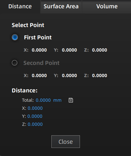
Calculate the distance between two points or markers on the surface of the scanned model.
When you select two points of the model, the distance will show itself at once. Note
Note
● You can tick the checkbox before First Point or Second Point and re-select the point.
● Total is the 3D distance; X, Y, and Z are the projection length of the segment to respective planes.
● You can select marker measurement for model data that only have markers and are not meshed yet.
Click Close to close the front window.
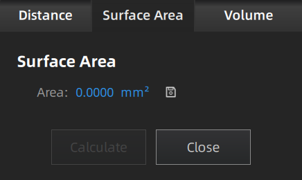
Calculate selected area of the scanned model.
You can use edition tools, right panel, or shortcuts on the bottom panel to select the area. Click Calculate and the area will show itself with a unit of mm².
Click Close and close the front window.Note
This function is only available for meshed models.
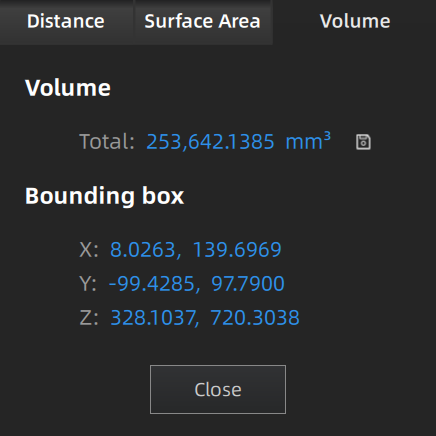
Calculate the volume of Meshed data with a unit of mm³. When you switch to Volume, the volume of the scanned model and the coordinates of corresponding bounding box will show themselves.Note
This function is only available for meshed models.
Click  and import the measurement result to local.
Note
- You can save the file as TXT or CSV or both.
- The storage path defaults to where you open the file last time, or to desktop if you have not set the path.